J2Ski Snow Report - January 16th 2025
J2Ski Snow Report - January 16th 2025
Published : 16-Jan-2025 16:21

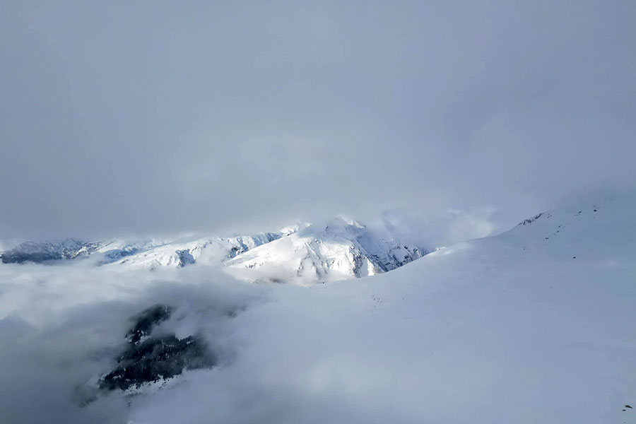
Typical views from La Rosiere, France, with great snow this week...
Good snow cover and sunshine in most of the Alps. Heavy snow in Alaska. A mixed forecast for the week ahead.
The Snow Headlines - January 16th
- Alaskan ski area tops 7.5 metres so far this season.
- Sunshine dominates the weather in the Alps this week.
- Scottish ski areas see 30C temperature rise in less than 24 hours.
- 2025 Freeride World Tour gets greenlight to kick off in Pyrenees this Friday.
- Temperatures rise in Scandinavia, rainfall replaces snowfall for a time.

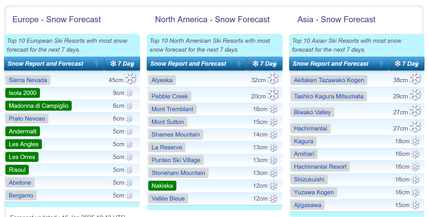
Snow forecasts worldwide.
Re-publication :- the J2Ski Snow Report Summary, being the text above this line, is free to re-publish, but must be clearly credited to www.J2ski.com with text including "J2Ski Snow Report" linked to this page - thank you.
World Overview
The sun returned to Western Europe after last week's fog, low clouds, and rain. Fortunately, temperatures have dropped too, with the clear skies, and slope conditions are widely reported to be much better than they were seven days ago. Avalanche danger has also dropped from last week's widespread Level 4 (High) but remains at Level 3 (Considerable) in much of the Western Alps.
Elsewhere in Europe the Dolomites and Pyrenees could still do with a lot more snowfall after another largely dry week, but still, most areas in these regions have most of their slopes open, with thin cover.
Eastern European destinations have seen cold and snowy weather, but northern Europe saw a big rise in temperatures to start this week – bad news for Scotland and Scandinavia.
In the wider world, Japanese ski areas continue to lead in snow depth, up above 4 metres in several cases.
Beyond fires in Los Angeles and snowfall in southern states, North America's main ski areas have had a fairly quiet week with little or no snowfall, except in the northern Rockies region and New England where some centres have had seven-day totals of up to half a metre. Snow depths keep improving and more terrain is opening at centres across the continent, where an increasing number are now fully open.
Europe
Austria
Austria is now enjoying sunny weather after experiencing some of the coldest and snowiest conditions in the Alps over the weekend due to a cold front from the northeast.
The forecast for the coming week shows predominantly dry conditions, with only occasional snow showers expected. The great news, apart from the weather stability, is that temperatures are remaining fairly low, which means there will be minimal daytime thawing, and overnight snowmaking can continue.
The Arlberg region, including St. Anton and Lech, boasts over 150 miles of open slopes, while all major Austrian areas have between 80-100% of their slopes accessible. The Skiwelt, Ischgl-Samnaun (Silvretta) and Saalbach Hinterglemm all have over 200km of slopes open too.
France
Following last week's mixed bag of weather, which included wind, sleet, fog, rain, and occasional snowfall, a spell of dry, sunny weather has settled in the French Alps since Sunday, bringing much-needed stability and improved surfaces to groomed runs.
Temperatures have also dropped, with overnight lows below -10°C, which is excellent news for snowmaking efforts and keeping daytime temperatures from rising too high.
The forecast suggests a continuation of these conditions over the coming week, although temperatures may rise slightly but will remain manageable.
Most French ski areas are close to fully open and Les Arcs is posting Europe's deepest snow at 2.8 metres.
The Portes du Soleil (Morzine, Avoriaz, Les Gets, and Châtel) and Les 3 Vallées (Val Thorens, Les Menuires, Meribel and Courchevel) each have more than 550 km of open slopes, the most in the world.
Italy
A largely sunny week for Italy as well. With much of the country not having had as much snowfall as further west and north over the past few months, bases remain thin, as low as 20-30cm of mostly machine-made snow for much of the Dolomites.
That said Italian areas are nonetheless mostly fully open, or nearly so, and have actually had more reliable piste conditions than some of the deep snow destinations in the Western Alps.
There's not much change in the forecast; just another week of sunshine and temperatures in the -10C to +8C range. Centres with around 200km of slopes or more open include Val Gardena, Cervinia and the Via Lattea/Milky Way around Sestriere and Sauze D'Oulx.
Switzerland
Swiss centres have enjoyed a mostly sunny week too since the weekend, although with some seeing heavy snowfall prior and then light accumulations on Wednesday/Thursday.
Saas-Fee was one of the big winners seeing its upper base grow by more than 30cm/10% to more than 2.6 metres, the most in the country.
Most Swiss resorts are now 90-100% open although big players like the 4 Valleys around Verbier are still at about 75%. The cross-border Portes du Soleil region linked to resorts in France but accessible from several centres including Morgins and Champery on the Swiss side, has the most terrain open accessible from Switzerland, although the majority of it is in France – about 550km of slopes at present.
Scandinavia
It's been a bit of a mixed week in Scandinavia. The main problem has been a jump in temperatures which has seen snow cover drop dramatically at some big-name areas like Hemsedal, and snow turn to rain elsewhere.
Temperatures are expected to be back below freezing by the start of next week.
The region's largest resort, Sweden's Are, has managed to get close to 100% open despite the weather challenges.
Pyrenees
Some snow showers in the Pyrenees this week, but not really amounting to much in the greater scheme of things and there's no change in reported base depths nor open terrain.
That remains at 50-70% for the bigger resorts including Andorra's Grandvalira (the biggest, incorporating Soldeu, Pas de la Casa and others).
Some French centres like Piau Engaly have more open (over 90% of its slopes in its case), whilst others, particularly on the Spanish side, are still down at a meagre 20-30%.
Spain's Baqueira Beret got the green light to host the opening of the 2025 Freeride World Tour this Friday, despite the snow cover, but the venue has been changed from publicly visible terrain to a more remote, but snowsure, area.
Scotland
There was disappointment for Scottish ski centres after a straight 10 days of sub-zero temperatures, with reported lows of -20C, and enough natural snow to open terrain at ski areas including Cairngorm, Glenshee and The Lecht at the weekend.
Sunday night saw temperatures rise significantly, to more than +10C by Monday lunchtime, rapidly thawing the thin fresh cover. That means they're back to small areas of machine-made snow for the time being.
Temperatures are dropping a little after a mild week so far, but not yet back to the cold of last week.
Eastern Europe
It's been a pretty good week for most parts of eastern Europe with colder, snowier weather reported in recent days compared to ski regions both north, south and west of the Balkans and Carpathians!
Ski centres in Czechia, Poland and the Slovak Republic all reported 20-50cm accumulations up to Tuesday and powder conditions.
In Bulgaria, base depths are up 20-30cm and the leading centres including Borovets and Bansko are close to 100% open.
North America
Canada
It's been a rather dry week across Canada, with most centres only seeing 10-20cm snowfall totals.
Unusually for this season, the East Coast has perhaps seen slightly more snowfall than the West over the past seven days, with Quebec's Mont Sutton posting over a foot of snow and noting it's fully open for the first time in winter 24-25.
In the West, many of British Columbia's well-known resorts are already fully open and the continent's biggest resort, Whistler Blackcomb, is almost there, now 97% open.
It's looking like a similar week for the weather ahead with no big snowfalls forecast and temperatures staying below freezing, in fact getting as low as -20C overnight.
USA
It's been a fairly good week for snowfall across the US, although we have not seen anything too dramatic.
The East Coast, which has had a challenging winter due to warm weather and limited snowfalls, saw some of the biggest accumulations this week.
Some falls, in upstate New York in particular, were tied to 'Lake Effect' events driven by Polar air from the north.
Further south "Storm Blair" brought heavy snow to states like Virginia.
In terms of destination resorts in the west it's been mostly dry and sunny on the Pacific coast, but that's not stopped Alaska's Alyeska reporting it has now had over 300 inches (7.5 metres) of snowfall so far this winter, the most in North America.
Inland, the biggest falls were reported in the Rockies with several feet in the last seven days in Utah, Idaho and Wyoming meaning most areas there are now fully open (or almost so) with great conditions.
Join the conversation : Discuss this in the J2Ski Forum
This news item has been viewed 6,239 times.
Also on J2Ski :- Morzine Snow Forecast Ski Hotels Ski Hire Ski Holidays