J2Ski Snow Report - March 13th 2025
J2Ski Snow Report - March 13th 2025
Published : 13-Mar-2025 22:24

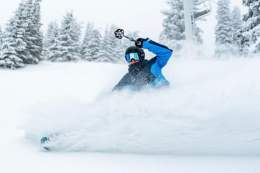
Silverstar, BC, Canada, had another powder day...
Sunny in the Alps, snow in the Rockies and (again) in Japan. Snow in the forecast for some parts of the Alps, Dolomites and Pyrenees next week.
The Snow Headlines - March 13th
- Snow returns to the Alps with up to 60cm in 72 hours reported in Southern France.
- Snowfall continues and intensifies in the Pyrenees as avalanche risk level rises.
- 2 Feet (60cm) of snowfall in 72 hours for Whistler Blackcomb.
- Warm temperatures in Bulgaria with lower slopes seeing close to +20C in afternoons.
- Scottish ski area calls it a day on 24-25 ski season.

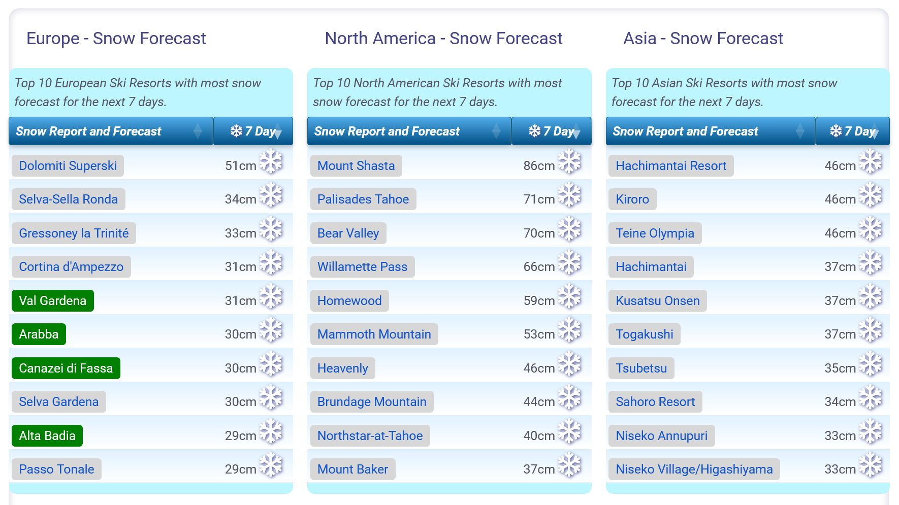
Snow forecasts worldwide.
Re-publication :- the J2Ski Snow Report Summary, being the text above this line, is free to re-publish, but must be clearly credited to www.J2ski.com with text including "J2Ski Snow Report" linked to this page - thank you.
World Overview
The weather has turned wintery in the Alps, with a front moving up from the Southwest bringing heavy snowfall that is progressively moving north and east. Accumulation totals have now reached 60cm for some slopes in southern France but its been more like 10-30cm in most areas.
Snowfall has also continued and actually intensified in the Pyrenees, with reports of up to 40cm of fresh in 24 hours on the Spanish side of the border pushing the avalanche danger up to 'considerable'.
Elsewhere in Europe, Scandinavia has had a mostly cold but sunny and dry week, with the snow staying in good condition. Sunny too down in Bulgaria but here it's been very warm, in the high teens, although so far slopes remain open thanks to established snow depths.
In North America, Whistler Blackcomb posted the most snowfall in the world this week, nearly 1.5m (5 feet) over the last seven days.
Japan's Tengendai Kogen Ski Area continues to post the deepest base in the world; now up to 7.8m (25 feet).
Europe
Austria
Whilst the Alps have had snowfall this week, it's been the south and western Alps that have seen the most, whilst Austria's northeasterly location has been slightly drier. There has been a lot more cloud though with temperatures a degree or two cooler, but still in the -10 to +10C range with freeze-thaw conditions up to about 2,500m altitudes the norm.
There have been some snowfalls reported, mostly in the west and south of the country, but these have been more in the 5-10cm bracket on the whole and some areas have seen rain and sleet at lower elevations.
Most Austrian areas have at least 80% of their slopes still open and some like Kitzbuhel and Obertauern remain at 100%. Sunny spells and snow showers are expected to continue through the weekend.
France
France has experienced a snowy week, with significant snowfall over the past few days and more in the forecast.
The southern French Alps have seen the heaviest accumulations, with Serre Chevalier recording 60cm (2 feet) of fresh snow on its highest slopes in the last three days.
Risoul and Vars have also received about 30cm of new snow in the same period.
Across the country, all the major ski regions are nearly fully open, with higher slopes in areas like Tignes, Val d'Isère, Courchevel, and Meribel receiving 20-40cm of snowfall.
The snowy conditions are set to continue into next week, with elevated Avalanche Risk, before milder temperatures follow.
Italy
Italy has seen a relatively positive week for snowfall during what has otherwise been a fairly dry winter season of 2024-25 so far.
Following last week's sunshine, skies have mostly been cloudy, with daily light to moderate snowfalls—most pronounced in the western areas.
The Dolomites, which have struggled with base depths often below 50cm throughout the season, experienced a rare treat of powdery conditions this week. Among the resorts benefiting from this were Madonna di Campiglio and Cervinia, both of which reported 20cm of fresh snow and excellent powder conditions at the start of the week.
However, daytime temperatures continue to rise well above freezing at lower elevations, meaning the finest conditions are found at higher altitudes, while lower slopes occasionally see rain or sleet.
Switzerland
Swiss ski resorts had cloudy weather with light snow this week.
The south and west, including Saas-Fee and Zermatt, received 20-30cm of snow on higher slopes. Verbier reported a 28cm accumulation on Thursday.
Although temperatures in lower valleys reached +10°C, causing some thawing, most resorts report 80-100% of slopes open. More snowfall is expected this weekend before drier weather next week.
Scandinavia
There have been snowfalls this week in Scandinavia, contributing an additional 10-20cm to base depths.
However, high-pressure conditions have mostly prevailed, bringing abundant sunshine to the region. With longer daylight hours, ski centres can now open all slopes with snow cover, expanding beyond the floodlit runs used during midwinter. As a result, more terrain continues to become accessible.
Additionally, temperatures have largely stayed below freezing, ensuring that snow conditions remain exceptional—among the best in Europe at the moment.
Pyrenees
The Pyrenees posted some of the biggest snowfalls in Europe at the weekend with accumulations of up to 40cm in 24 hours reported on the Spanish side of the mountain range.
Andorra's Grandvalira posted 25cm in 24 hours to start the week and has had more snowfalls since. It continues to have the most terrain open in the region, about 80% of its full area and the most its had open all season. It describes snow conditions as 'powder'.
Scotland
Scotland's troubled 24-25 ski season has continued with more very mild temperatures over the weekend melting most of what was left of any hill snow and leading The Lecht to announce it was closing for the season. Nevis Range is yet to open.
That leaves three areas – Cairngorm, Glencoe and Glenshee still open (although Glencoe was forced to close over the weekend by the warm temperatures) and the good news for them is that temperatures dropped to something more wintery and hill snow returned on Sunday/Monday. The problem is a lot is needed before the next warm snap to rebuild bases. For now, each has their small areas of slopes maintained by their all-weather snowmaking systems.
Eastern Europe
Conditions are becoming increasingly challenging in southeastern Europe, simply because its been getting so warm with non-stop sunshine in the Balkans, and there's no real change forecast.
Bansko and Borovets remain mostly open thanks to accumulated snow on higher slopes but it's been reaching +10C even on mountain tops in Bulgaria.
The issues aren't quite so serious further north with ski areas in the Czech Republic, Poland and Slovakia seeing similar temperatures to the Alps and after a dry start to the week rain, sleet and snow showers are now moving in here.
North America
Canada
A great week in Western Canada with temperatures staying low and everywhere reporting a foot or two of fresh snowfall to bring powder conditions across the region.
Whistler Blackcomb was one of the big winners reporting 60cm (2 feet) in 72 hours to start the week with the snow falling right across the region, it was 1.4m (5 feet) over the past 7 days as of this Thursday.
Jasper's Marmot Basin over in Alberta posted 30cm in the same period and powder conditions there.
Over on the East Coast it's been a little less snowy and we've had the ongoing issue of rising temperature spikes bringing rain and thawing at times, as well as strong winds causing issues, but it's been dry overall and most areas remain fully open.
More snowfall for the West later this week, warm weather possible in the East at the weekend.
USA
The US has had quite a quiet week for snowfall after the big metre-plus accumulations in the Rockies that ended last weekend. Things have been changing again after a sunny week in the west though with up to a foot of snow reported in the Utah Rockies in the past 24 hours and a major storm impacting California from the Pacific, with up to 1.2m of snowfall forecast to hit by the end of the weekend.
Strong winds and blizzard conditions have temporarily closed a lot of areas in the past few days though.
On the East Coast warm temperatures are back to being an issue with dry but warm weather although there's now a temperature drop and return of snowfall in the forecast.
Join the conversation : Discuss this in the J2Ski Forum
This news item has been viewed 17,758 times.
Also on J2Ski :- Val d'Isère Snow Forecast Ski Hotels Ski Hire Ski Holidays